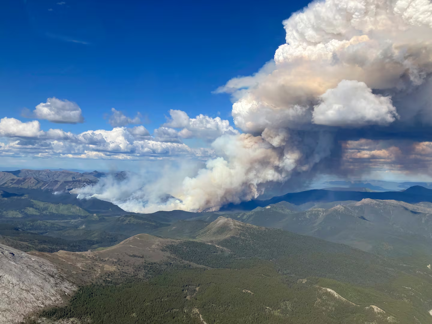
The 2023 Canadian wildfire season burned approximately 18 million hectares — the largest area ever recorded in a single season, surpassing the previous record by nearly three times. The 2024 season, while somewhat smaller in total area burned, saw more fires threaten populated areas and required the evacuation of over 200,000 Canadians. Climate researchers and forest fire scientists say these are not anomalies — they are the new trajectory.
Natural Resources Canada's Canadian Forest Service publishes annual fire statistics and projections. Its modelling, consistent with international climate research, shows that Canada's fire weather risk — a composite index incorporating temperature, humidity, wind, and fuel dryness — will increase across virtually all forested regions under every credible emissions scenario through mid-century, with the increases most pronounced in British Columbia, Alberta, and the boreal forest regions of Ontario and Quebec.
The Science of Why It's Getting Worse
Canada's boreal forest, which covers approximately 270 million hectares and represents one of the world's largest intact forest ecosystems, is experiencing temperature increases at roughly double the global average rate. Warmer temperatures dry forest fuels faster, extend the fire season at both ends, and increase the frequency of extreme fire weather events.
Researchers also point to fuel accumulation as a contributing factor. Decades of fire suppression policy — designed to protect timber resources and communities — have allowed fuel loads to build in forests that historically burned on natural cycles. When fires now start in these fuel-heavy areas, they are more intense and harder to control than historical fires in the same landscapes.
The mountain pine beetle outbreak that devastated British Columbia's lodgepole pine forests in the 2000s and 2010s left tens of millions of hectares of standing dead timber — ideal wildfire fuel — across much of the province's interior. Researchers at the University of British Columbia have linked beetle-killed forest areas to elevated fire intensity in subsequent fire seasons.
The Community Risk Challenge
Approximately 2 million Canadians live in the wildland-urban interface — areas where homes and communities are adjacent to or intermixed with forested land. These communities face wildfire risk that is manageable with adequate preparation but can turn catastrophic with insufficient lead time or inadequate defensible space around structures.
FireSmart Canada, a national program that provides guidance on community and homeowner wildfire risk reduction, has seen significantly increased engagement since 2023. Provincial and municipal governments in high-risk areas have stepped up FireSmart audits, community planning requirements, and evacuation planning.
What Individuals and Communities Can Do
- Create defensible space: Clear vegetation within 10 metres of structures and reduce fuel density within 30 metres. This is the single most effective individual action for reducing structure loss in wildfires.
- Know your evacuation route: Many communities in high-risk areas have multiple designated evacuation routes. Know at least two, and know which local authority issues evacuation orders.
- Prepare a go-bag: The BC Wildfire Service and Alberta Emergency Management recommend a go-bag that can be ready within minutes, containing documents, medications, and essentials for 72 hours.
- Follow FireSmart guidelines: Provincial FireSmart programs provide free assessments and specific recommendations for individual properties in high-risk zones.
Wildfire risk is not evenly distributed, and individual preparedness cannot substitute for the larger work of community planning, forest management, and climate policy. But for Canadians in high-risk areas, understanding that risk and taking practical steps can be the difference between a managed evacuation and a catastrophic loss.